
JOURNEYS:
READING
THE WORLD
Scroll down to begin
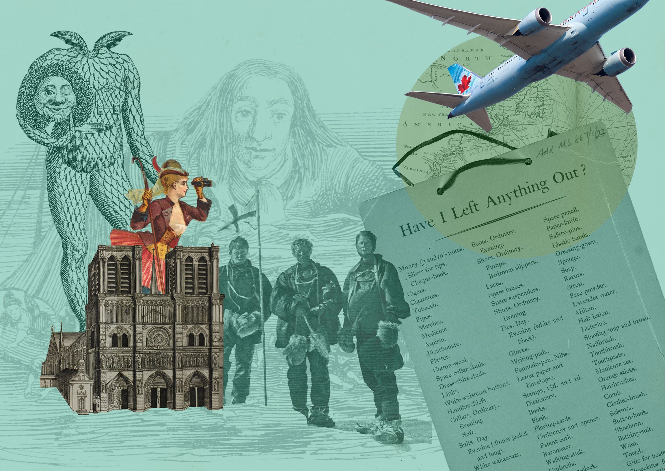

We all make journeys.
From our daily travels to once in a lifetime adventures, the places we go and things we encounter have the power to change and shape our lives.
Through their writings and records, travellers throughout history have expanded our knowledge of the world and encouraged us to venture out on journeys of our own.
The books, diaries, maps and images in this exhibition take us from the 1300s right up to the present day, revealing ideas, debates and awkward truths more relevant now than ever before.
Choose your path wisely as you journey around the world with explorers and scientists; pirates and artists; pilgrims and philosophers.
Man cannot discover new oceans unless he has the courage to lose sight of the shore.
Andre Gide

Attention Spotify users: why not listen to our exhibition playlist while you explore.

Our visitors have been telling us about their dream journeys. Let us know where you want to visit!
Just a flying visit?
Here are four remarkable items from Durham University’s special collections exploring the theme of journeys.


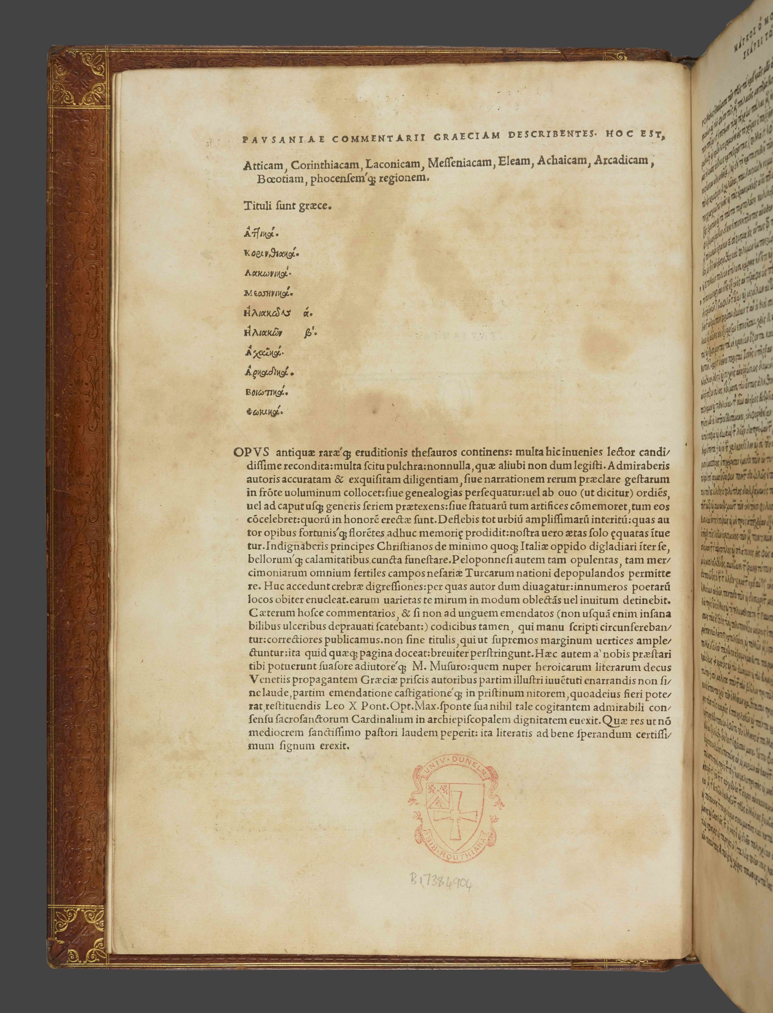


Pausanias, Description of Greece. Venetiis: In aedibvs Aldi, et Andreae soceri mense Ivlio, 1516. SB+ 0061. Originally written in the second century, this is the earliest surviving guidebook from Ancient Greece. Pausanias records the memorable places and monuments he visited, as well as discussing mythology, history and religion.
Pausanias, Description of Greece. Venetiis: In aedibvs Aldi, et Andreae soceri mense Ivlio, 1516. SB+ 0061. Originally written in the second century, this is the earliest surviving guidebook from Ancient Greece. Pausanias records the memorable places and monuments he visited, as well as discussing mythology, history and religion.

Pausanias, Description of Greece. Venetiis: In aedibvs Aldi, et Andreae soceri mense Ivlio, 1516. SB+ 0061. The value and accuracy of the work has been disputed over the centuries, but many modern day archaeologists believe the account to be a genuine and useful source of information.
Pausanias, Description of Greece. Venetiis: In aedibvs Aldi, et Andreae soceri mense Ivlio, 1516. SB+ 0061. The value and accuracy of the work has been disputed over the centuries, but many modern day archaeologists believe the account to be a genuine and useful source of information.

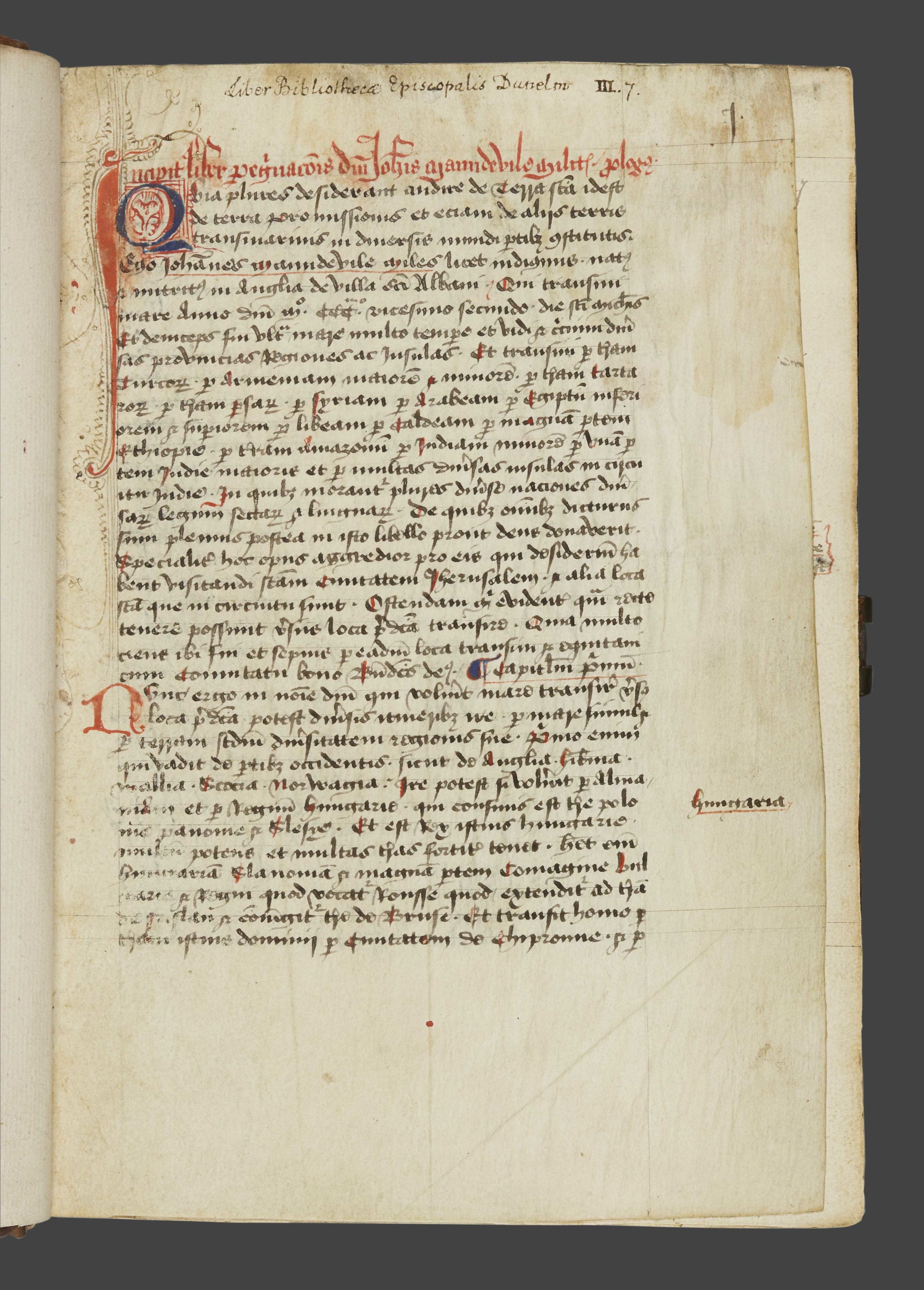
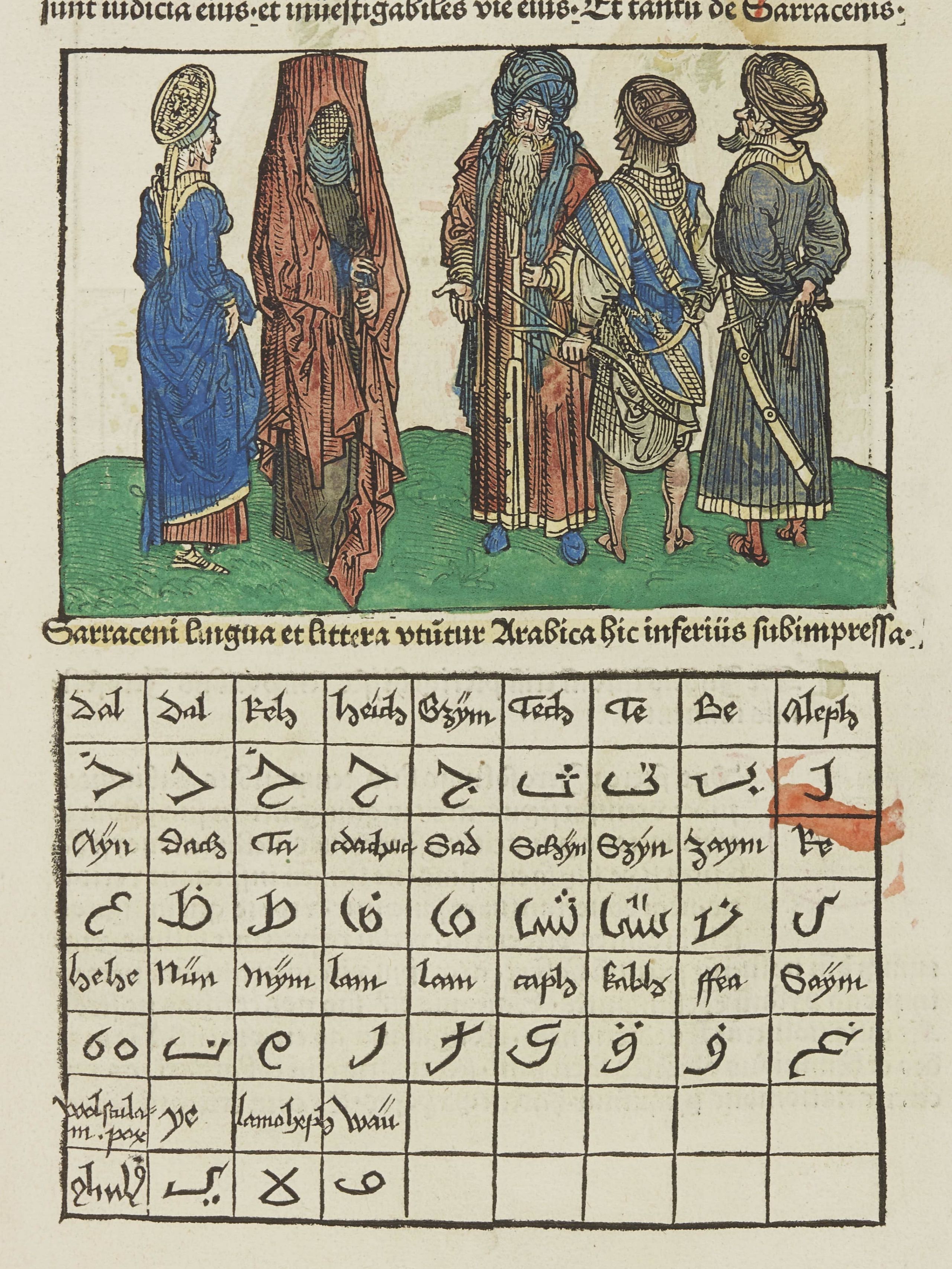
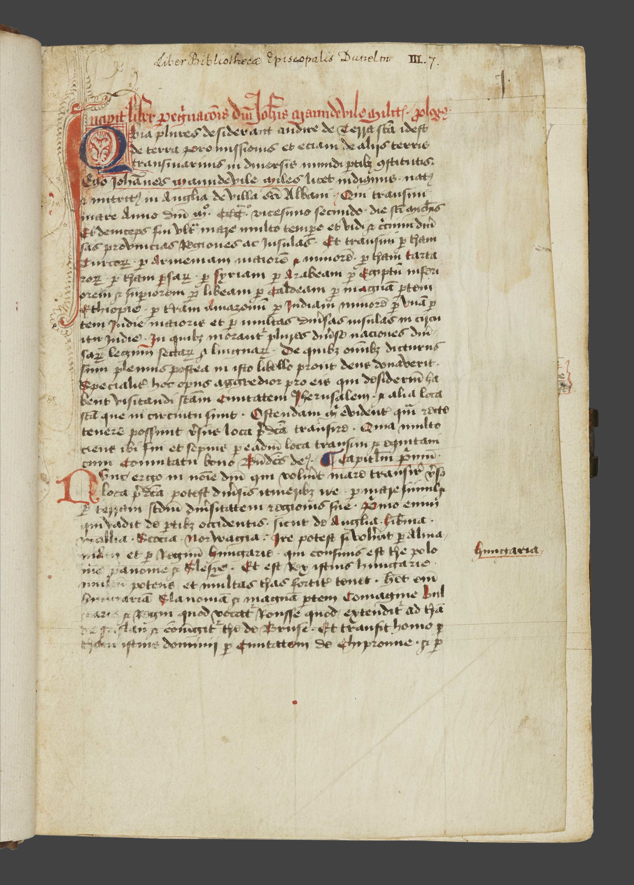
Sir John Mandeville, Travels. England, late 15th-century, Latin. MS. Cosin V.iii.7. This account of a journey through Asia first appeared in France in the mid-1300s. Despite its fictitious descriptions of strange lands and monsters on the edges of the known world, the account was widely believed until the 1600s when greater knowledge of the world disproved some of the more lavish claims.
Sir John Mandeville, Travels. England, late 15th-century, Latin. MS. Cosin V.iii.7. This account of a journey through Asia first appeared in France in the mid-1300s. Despite its fictitious descriptions of strange lands and monsters on the edges of the known world, the account was widely believed until the 1600s when greater knowledge of the world disproved some of the more lavish claims.

Sir John Mandeville, Travels. England, late 15th-century, Latin. MS Cosin V.i.10.2. Around 300 manuscripts of the work survive, with previous owners including Leonardo Da Vinci and Christopher Columbus, who consulted the book when planning his own voyages. Although the text is credited to ‘Sir John Mandeville’, the real identity of the author remains unknown.
Sir John Mandeville, Travels. England, late 15th-century, Latin. MS Cosin V.i.10.2. Around 300 manuscripts of the work survive, with previous owners including Leonardo Da Vinci and Christopher Columbus, who consulted the book when planning his own voyages. Although the text is credited to ‘Sir John Mandeville’, the real identity of the author remains unknown.

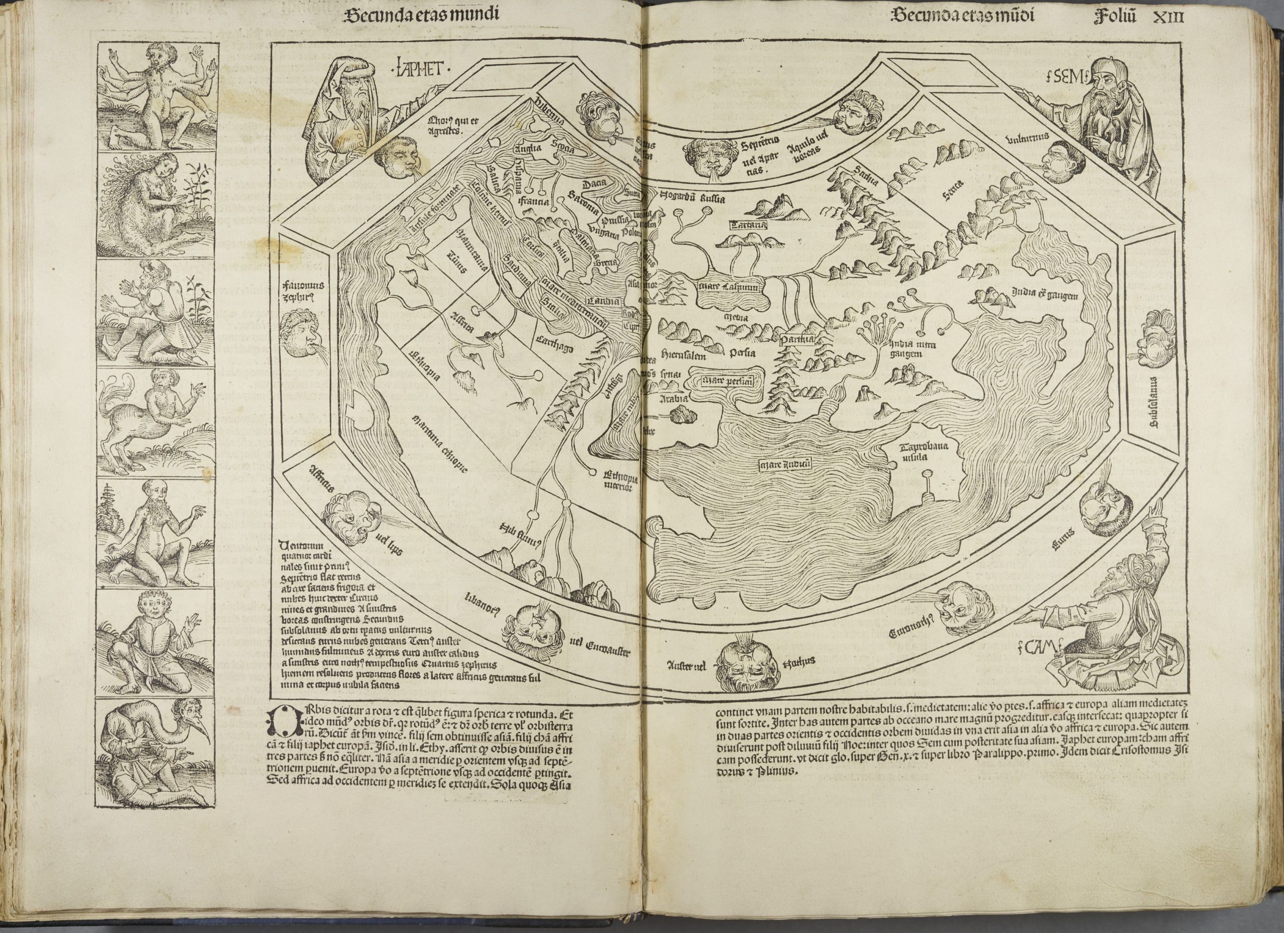
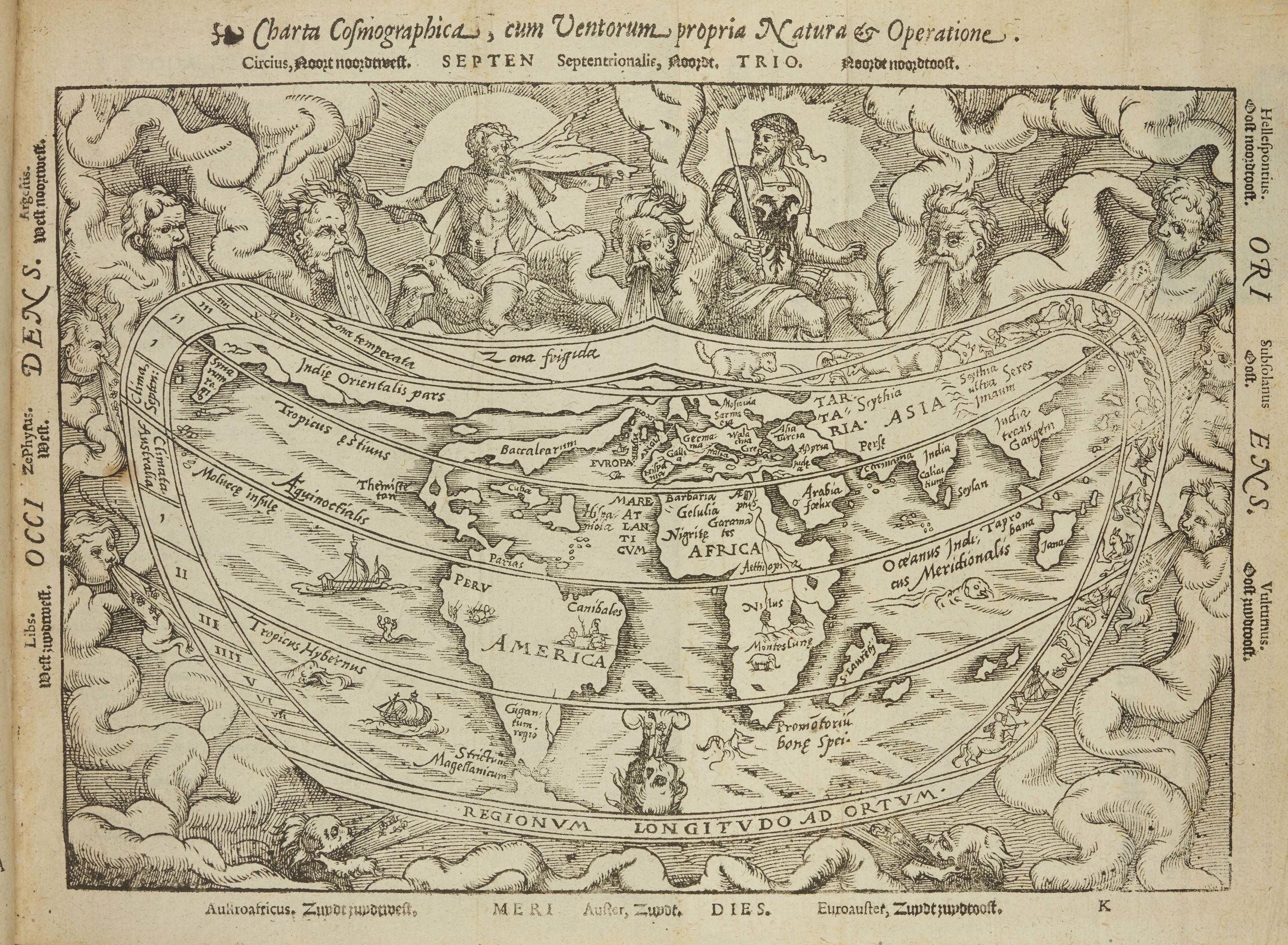
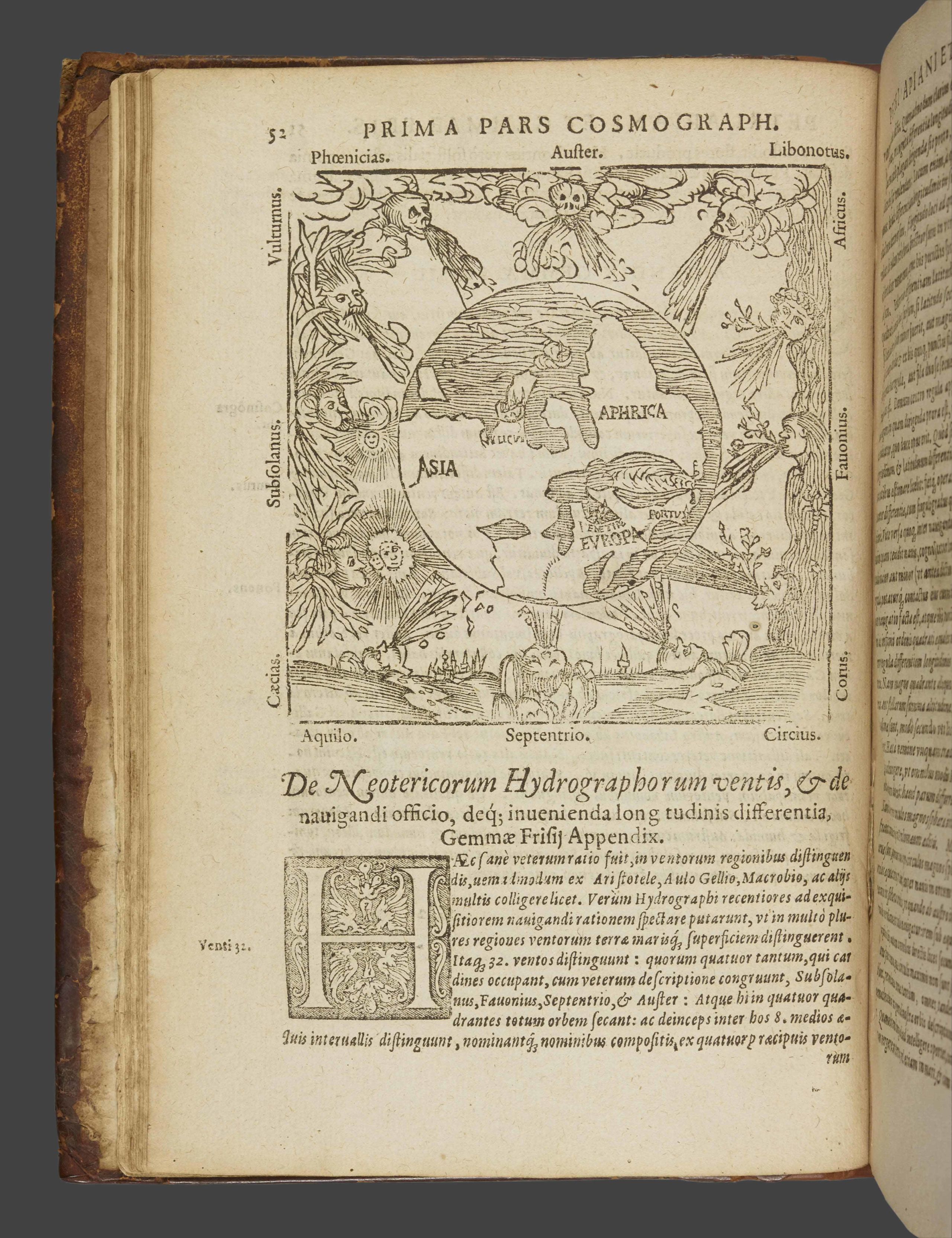
Petrus Apianus, Cosmographia, Antverpiae : Ex officina Arnoldi Coninx [typis Joan. Withagii], 1584. SB 0045. First published in 1524, this is the first work by mathematician, geographer and astronomer Petrus Apianus. Hugely popular and influential, the work was republished in 29 editions and widely used by explorers and mapmakers.
Petrus Apianus, Cosmographia, Antverpiae : Ex officina Arnoldi Coninx [typis Joan. Withagii], 1584. SB 0045. First published in 1524, this is the first work by mathematician, geographer and astronomer Petrus Apianus. Hugely popular and influential, the work was republished in 29 editions and widely used by explorers and mapmakers.

Petrus Apianus, Cosmographia, Antverpiae : Ex officina Arnoldi Coninx [typis Joan. Withagii], 1584. SB 0045. Apianus focuses on the different climatic zones of the earth and discusses methods for calculating distances of travel, revealing the knowledge and skills required by explorers in the 1500s as they embarked on long and dangerous journeys.
Petrus Apianus, Cosmographia, Antverpiae : Ex officina Arnoldi Coninx [typis Joan. Withagii], 1584. SB 0045. Apianus focuses on the different climatic zones of the earth and discusses methods for calculating distances of travel, revealing the knowledge and skills required by explorers in the 1500s as they embarked on long and dangerous journeys.

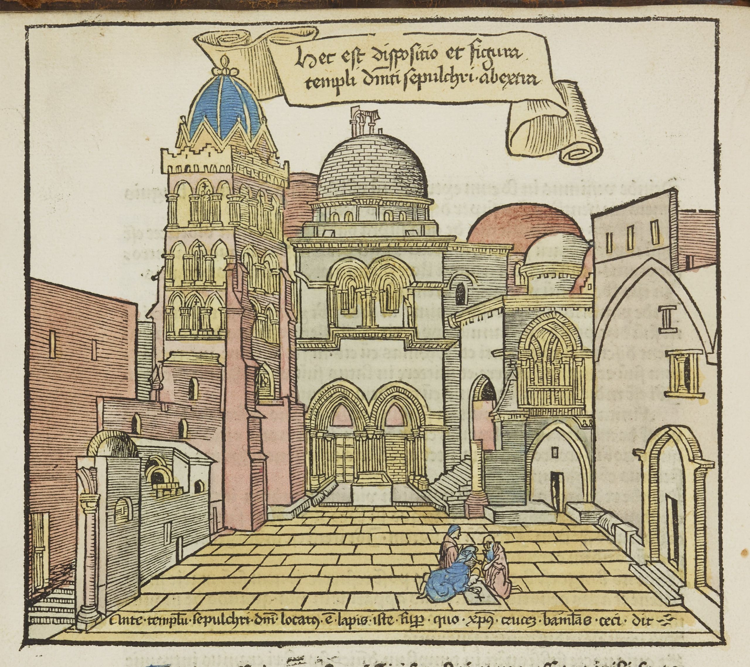
Bernhard von Breydenbach, Peregrinatio in terram sanctam. Mainz: Erhard Reuwich, 11 February 1486. SA 0120. This is widely thought to be the first printed travel guide with illustrations. The title translates as Pilgrimage to the Holy Land and details Breydenbach’s journey to Jerusalem via Venice, Corfu and Rhodes, which he undertook with two companions from April 1483 to January 1484.
Bernhard von Breydenbach, Peregrinatio in terram sanctam. Mainz: Erhard Reuwich, 11 February 1486. SA 0120. This is widely thought to be the first printed travel guide with illustrations. The title translates as Pilgrimage to the Holy Land and details Breydenbach’s journey to Jerusalem via Venice, Corfu and Rhodes, which he undertook with two companions from April 1483 to January 1484.

Bernhard von Breydenbach, Peregrinatio in terram sanctam. Mainz: Erhard Reuwich, 11 February 1486. SA 0120. One of Breydenbach’s fellow travellers was the illustrator Erhard Reuwich, who is responsible for the rich illustrations throughout the book, including views of Jerusalem and Egypt which, at the time, were the most accurate and lively depictions of these places in existence.
Bernhard von Breydenbach, Peregrinatio in terram sanctam. Mainz: Erhard Reuwich, 11 February 1486. SA 0120. One of Breydenbach’s fellow travellers was the illustrator Erhard Reuwich, who is responsible for the rich illustrations throughout the book, including views of Jerusalem and Egypt which, at the time, were the most accurate and lively depictions of these places in existence.

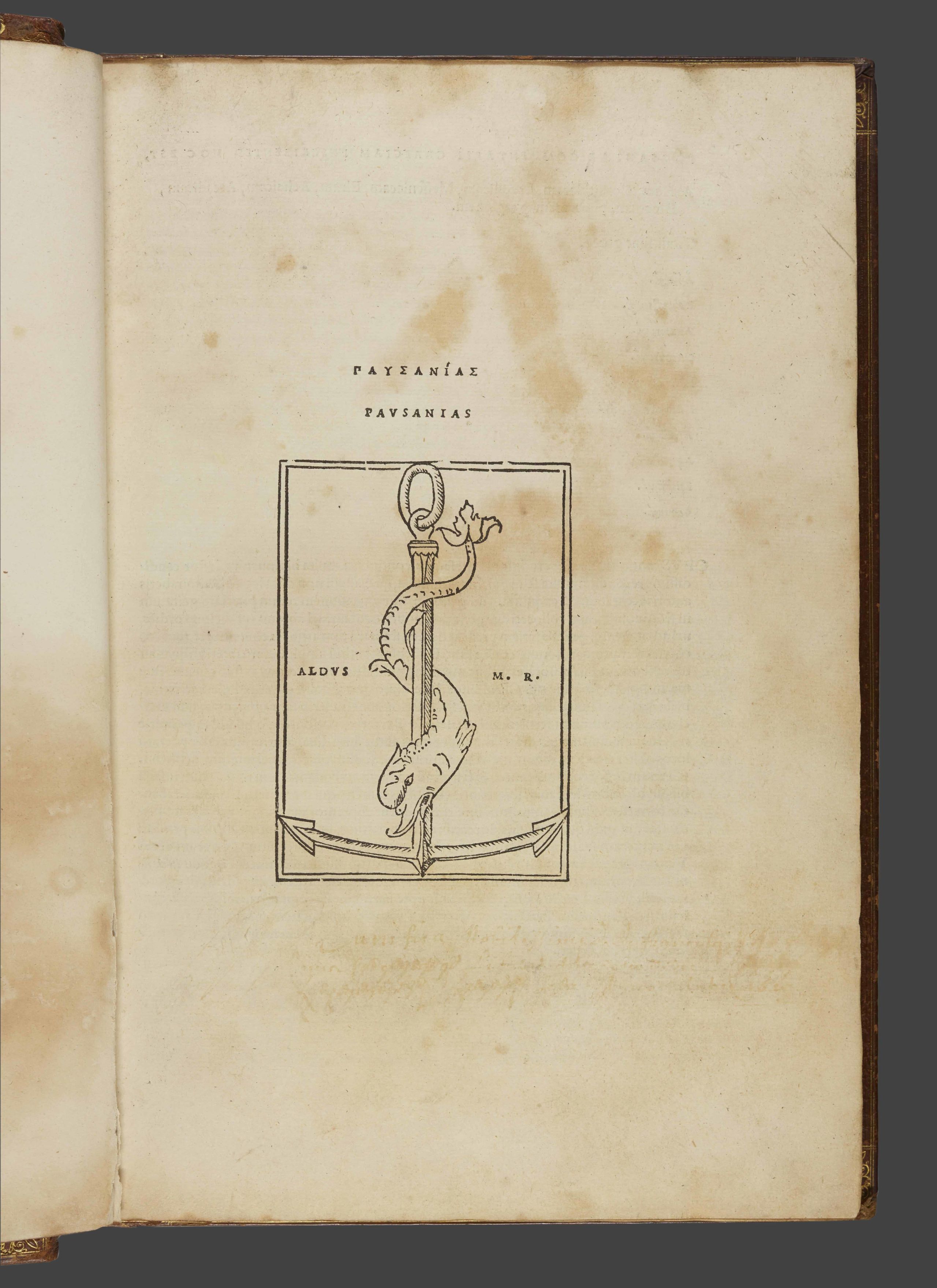
Pausanias, Description of Greece. Venetiis: In aedibvs Aldi, et Andreae soceri mense Ivlio, 1516. SB+ 0061. Originally written in the second century, this is the earliest surviving guidebook from Ancient Greece.
Pausanias, Description of Greece. Venetiis: In aedibvs Aldi, et Andreae soceri mense Ivlio, 1516. SB+ 0061. Originally written in the second century, this is the earliest surviving guidebook from Ancient Greece.
The value and accuracy of the work has been disputed over the centuries, but many modern day archaeologists believe the account to be a genuine and useful source of information.
The value and accuracy of the work has been disputed over the centuries, but many modern day archaeologists believe the account to be a genuine and useful source of information.
Sir John Mandeville, Travels. England, late 15th-century, Latin. MS. Cosin V.iii.7. This account of a journey through Asia first appeared in France in the mid-1300s. The work describes strange lands and monsters on the edges of the known world.
Sir John Mandeville, Travels. England, late 15th-century, Latin. MS. Cosin V.iii.7. This account of a journey through Asia first appeared in France in the mid-1300s. The work describes strange lands and monsters on the edges of the known world.
Sir John Mandeville, Travels. England, late 15th-century, Latin. MS Cosin V.i.10.2. Although the text is credited to ‘Sir John Mandeville’, the real identity of the author remains unknown.
Sir John Mandeville, Travels. England, late 15th-century, Latin. MS Cosin V.i.10.2. Although the text is credited to ‘Sir John Mandeville’, the real identity of the author remains unknown.
Petrus Apianus, Cosmographia, Antverpiae : Ex officina Arnoldi Coninx [typis Joan. Withagii], 1584. SB 0045. First published in 1524, this is the first work by mathematician, geographer and astronomer Petrus Apianus.
Petrus Apianus, Cosmographia, Antverpiae : Ex officina Arnoldi Coninx [typis Joan. Withagii], 1584. SB 0045. First published in 1524, this is the first work by mathematician, geographer and astronomer Petrus Apianus.
Apianus focuses on the different climatic zones of the earth and discusses methods for calculating distances of travel, revealing the knowledge and skills required by explorers in the 1500s as they embarked on long and dangerous journeys.
Apianus focuses on the different climatic zones of the earth and discusses methods for calculating distances of travel, revealing the knowledge and skills required by explorers in the 1500s as they embarked on long and dangerous journeys.
Bernhard von Breydenbach, Peregrinatio in terram sanctam. Mainz: Erhard Reuwich, 11 February 1486. SA 0120. This is widely thought to be the first printed travel guide with illustrations. The title translates as Pilgrimage to the Holy Land.
Bernhard von Breydenbach, Peregrinatio in terram sanctam. Mainz: Erhard Reuwich, 11 February 1486. SA 0120. This is widely thought to be the first printed travel guide with illustrations. The title translates as Pilgrimage to the Holy Land.
The book includes illustrations of Jerusalem and Egypt which, at the time, were the most accurate and lively depictions of these places in existence.
The book includes illustrations of Jerusalem and Egypt which, at the time, were the most accurate and lively depictions of these places in existence.